Council to vote on $30-million cycling master plan
But with a municipal election looming, whether the proposed 80 km of bike lanes and trails actually gets built will depend on future councils. Part three of our series about the future of transportation in Peterborough.
Correction: an earlier version of this article incorrectly stated that councillors voted to build 50 kilometres of new infrastructure as part of the cycling master plan, altering a pledge to build 80 kilometres. Quotes about the inaccurate information have been removed. The Peterborough Bicycle Advisory Committee “fully supports” the cycling plan as it was presented to council, Jean Greig, a committee member wrote by email. The article also now states that the $1.5 million a year that council has committed to cycling infrastructure is tied to inflation.
Update: Council voted to approve the cycling master plan on Monday March 28.
Peterborough’s 20-year, $30-million vision to expand cycling infrastructure goes to city council for a vote on Monday (March 28).
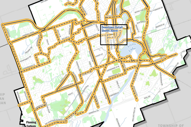
It’s the final hurdle for the plan – which calls for at least 80 kilometres of new bike lanes and trails by 2041 – after winning the support of council’s general committee earlier this month.
But the hard work is far from over, cycling advocates say, as they now turn their attention to making the vision a reality.
“It’s a pretty impressive plan,” said Jean Greig, a member of the Peterborough Bicycle Advisory Committee. “It’s going to come down to what actually gets done on the ground – that’s going to [determine] really how amazing it is.”
Council has already endorsed spending $1.5 million a year until 2041 to realize the cycling master plan – an amount that will rise with inflation each year, City spokesman Brendan Wedley wrote by email.
But whether that money actually makes it into the budget year after year will be up to future councils to decide.
“Who knows what the next council is going to do,” said councillor Kemi Akapo, who worked on the cycling plan as council’s former transportation chair. She has not said publicly yet whether she will seek re-election in the Oct. 24 municipal election. She urged people who care about cycling to follow future budget deliberations closely to ensure that bike lanes get funded, “regardless of who’s on council.”
What’s in the plan?
The ultimate vision is to one day have 253 kilometres of bike lanes and trails crisscrossing the city, more than tripling the current cycling network. But the plan doesn’t give a timeframe to build all of that infrastructure.
Instead, the first priority is to complete a “crosstown network” of cycling routes, which would allow cyclists to get around most of the city safely and efficiently, along many major routes.
The plan calls for bike lanes along several major streets within the next decade as part of the crosstown network, including:
- Charlotte Street between Aylmer and Park streets and between George and Water streets
- Chemong Road between Reid Street and Towerhill Road
- Lansdowne Street between Park Street and Lock Street
- Parkhill Road between Monaghan Road and Wallis Drive
- Sherbrooke Street between Brealey Drive and Glenforest Boulevard

If built, the crosstown network would give cyclists access to areas of the city, such as Chemong Road and Lansdowne Street, that currently feel “impossible” to reach on a bike, said Greig, who is also program manager at B!KE: The Peterborough Community Bike Shop.
The plan also calls for completion of the long-planned Crawford Trail, as well as the Parkway Trail, between Clonsilla and Sherbrooke streets, by 2031.
Another multi-use trail would eventually connect downtown Bethune Street to Ashburnham Drive, in the southeast end, via a decommissioned rail line. The aim is to build the first section, from Bethune Street to the Otonabee River, by 2031. The rest of the project, including conversion of a rail bridge over the Otonabee River, would be completed after 2041, according to the plan.
The City has already purchased the majority of the rail line and the swing bridge across the Otonabee River, wrote transportation demand management planner Sue Sauve in an email.
Councillor worries about loss of on-street parking
Councillor Lesley Parnell was the only one to vote against the cycling plan at general committee, saying she’d had “a number” of phone calls from residents who said they hadn’t been consulted and were worried about bike lanes taking away on-street parking.
But not all of the streets eyed for cycling infrastructure would necessarily lose street parking – some might not even get painted bike lanes, according to transportation manager Kevin Jones.
Some might just become “signed routes,” with signs along the street to indicate that it’s a cycling corridor, Jones told the committee. “[The cycling plan is] really just an indication of where the cycling infrastructure should be planned,” he said. “There’s a number of different versions [of what that could look like] in different areas that will achieve the objectives of the cycling plan.”
Those details would be worked out through future public consultations and implementation plans that will be required before any of the projects move forward, he said.
Greig said signed routes are fine along small residential streets. “But it’s not okay to do that on Clonsilla or Water or George or Lansdowne.” She said major streets need better infrastructure – such as bike lanes with physical barriers to separate cyclists from cars, and intersections designed to be safe for cyclists.
Make existing bike lanes and trails safer

The plan calls for upgrades to 12 kilometres of existing cycling infrastructure, including installing physical barriers along the George and Water street bike lanes, north of Parkhill Road, to protect cyclists from cars. Barriers could take the form of planters, flexible bollards or cement curbs, Sauve wrote.
Improvements are also planned to boost cyclist safety at several intersections and trail crossings, including at the busy intersection of Lansdowne Street and Monaghan Road, and where the Rotary Greenway Trail crosses George and Water streets, north of downtown.
Safety improvements could include pavement markings, new traffic signals or “traffic calming” features, Sauve wrote.
The plan also calls for the establishment of a “Priority Winter Cycling Network,” with a “high level” of snow clearing service, and a pilot project to better clear ice from some cycling paths, using salt brine and sweepers.
City eyes federal grant to build cycling infrastructure
Some cycling infrastructure projects, including a new river crossing near the Riverview Park and Zoo and a multi-use path along Towerhill Road, will depend on funding from other levels of government, according to a staff report.
Staff are preparing to apply for funding for cycling projects through the new Federal Active Transportation Fund, Jones told the committee. Peterborough Currents asked Sauve what those projects will be in an email, but did not receive a response by press time.
The cycling master plan also recommends adding cycling facilities along additional major streets between 2031 and 2041, including:
- Water Street from Hilliard Street to Carnegie Avenue
- Armour Road from Hunter Street to the Rotary Trail crossing near Cunningham Boulevard
- Parkhill Road from Armour Road to Television Road
- Clonsilla Avenue/Charlotte Street from The Parkway to Monaghan Road
- Reid and Rubidge Streets from Park Street to McDonnell Street
- Park Street from Parkhill Road to Wolfe Street

Author

Related Articles
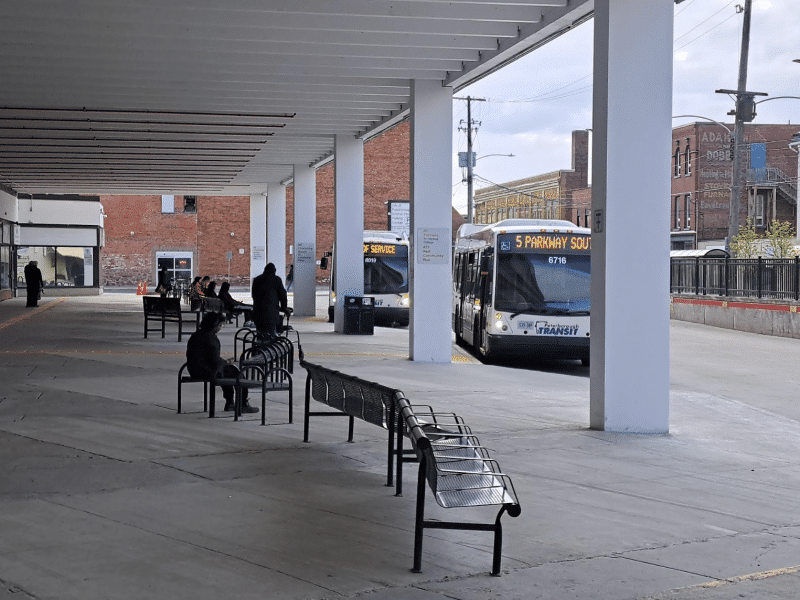
Riel commits to investing in buses
Would support Transportation Master Plan as mayor, despite uneven record as councillor
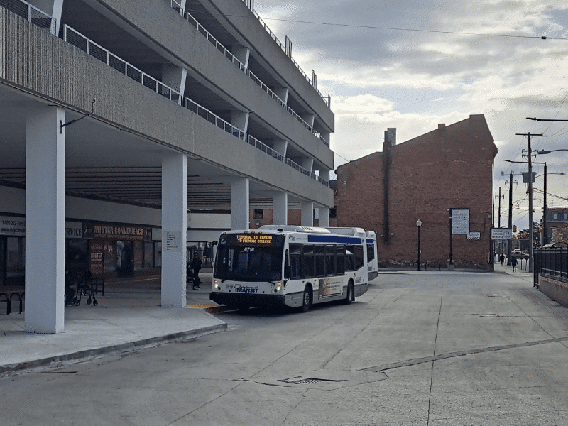
What do transit users think of the transit system?
Most voters in Peterborough never ride the bus

“Disappointing”: Peterborough moves away from traffic calming, despite data showing pilot projects led to reduced speeds
Councillors vote to study lowering speed limit to 40 km/hr city-wide instead