East of the City of Peterborough, the landscape is carved into hundreds of gentle hills — the Peterborough Drumlin Field. These hills were created thousands of years ago by the last glacier to cover this region. As the glacier retreated, it dragged the drumlins into place. As a result of being formed this way, these oblong hills are all oriented in the same direction the glacier was moving, with one end of their oval shape pointing to the northeast, and the other pointing to the southwest.
The parallel arrangement of these hills shapes the way water flows. Drumlins drain well; their silty soil is quick to let water pass through. In the low-lying areas between the hills, then, we find creeks and wetlands, and the creeks mirror the diagonal direction of the hills.

Have a look at Google Maps to see this for yourself. You can’t see the drumlins on the map, but you can observe their impact on adjacent watercourses. East of Peterborough, there are several creeks that are conspicuously straight, all flowing parallel to each other from the northeast to the southwest, the same direction as the drumlins.
Keep zooming in. One of these watercourses flows through Donwood and then enters the City of Peterborough as it passes underneath Parkhill Road. Then, it feeds into a pond, where its water rests for a bit before beginning a journey through East City toward the Otonabee River. This is Curtis Creek.

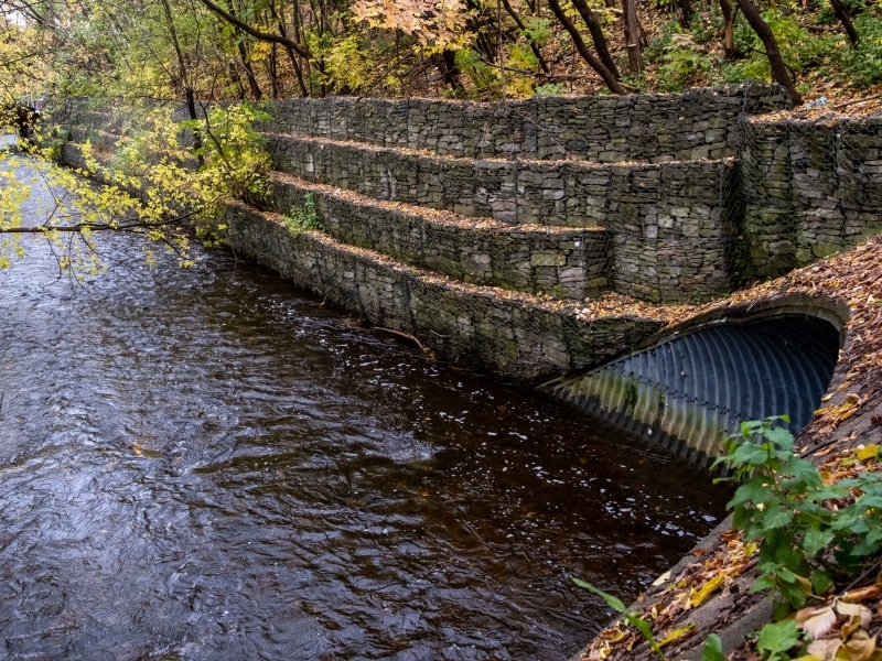
Curtis Creek approaches the Trent Severn Waterway shortly after it flows out from Curtis Pond. When it reaches the canal, the creek is corralled through one of the more curious feats of hydrological engineering in Peterborough. Curtis Creek flows underneath the Trent Severn Waterway in a culvert that is 1.5 metres wide.
“Water just doesn’t do that normally,” observes Mark Woolley, a local GIS consultant who finds this stretch of the creek fascinating. “Surface water stays on the surface,” he says. “Two watercourses don’t [normally] cross and keep going.”
But that’s what happens here — canal and creek intersect without blending. And on the other side of the canal, Curtis Creek emerges into East City, where it snakes through backyards until it reaches the Otonabee.
Between the canal and the river, Curtis Creek flows diagonal to the streets that make up the residential neighbourhood south of Parkhill Road East. Its deep ravine interrupts Woodbine Avenue completely, forcing the road to dead-end and pick up again on the creek’s other side. Then, the creek passes under Euclid Avenue and Caddy Street before approaching Armour Road.


Hayley Goodchild, a program coordinator at Peterborough GreenUP, lives near this portion of the creek. “When I moved into this neighbourhood in 2016, I didn’t have much of an understanding or an awareness of the creek,” she says.
Over the years, Goodchild came to sense its presence whenever she was close to home. “It ties the whole neighbourhood together. People appreciate that it’s there. They like the sound of the running water while they’re walking down the street or in the backyard.” And the creek offers children places to explore, she says.
But not long after Curtis Creek flows underneath Armour Road, its journey through East City is cut abruptly short. This creek has been diverted — perhaps more than any other in Peterborough.
According to the 1878 map of Peterborough, Curtis Creek used to continue flowing south, and its outlet into the Otonabee was just north of Little Lake, where the Engleburn Avenue neighbourhood is now.
Today, however, the creek is engineered to take a sharp bend toward the west after Armour Road. Soon after that bend, a culvert swallows the creek and dispatches it into the Otonabee River near Tivey Street. The creek’s final tumble into the river is shaped by a newly built concrete outlet, seen below in winter and summer.


The diversion of Curtis Creek into the Otonabee freed up some land to the south for development. But it also created a flood risk. That’s because the creek still remembers its old route, and would still prefer to follow it.
“Historically, we used to think that getting the water away as quickly as possible was the way to go,” says Ian Boland, who leads the City of Peterborough’s watershed planning projects. But we’ve moved beyond that understanding now, Boland says. “If you try to go up against nature and divert something, during a flood the chances are that the channel is going back to where it came from.”

Goodchild can speak to this firsthand. Her house is on Rogers Street, and the creek’s old route goes “right through my backyard,” she says. During heavy rains, “it would just spill over south and go back the way it used to. And we’d all end up with water in our backyards.”
Curtis Creek overflowed like this during the 2004 flood. In the years after that event, the entire subwatershed was studied with an eye to reducing flood risk in the future, and the resulting report found that the culvert built to carry Curtis Creek away from its historical route was too small. In heavy storms, the culvert would be overwhelmed and the creek would break free of the diversion.

The City’s consultants recommended upgrading the culvert, and in 2020 it finally happened. Now, two years after that project was completed, Goodchild reports that her backyard hasn’t flooded since.
The new culvert isn’t the only project undertaken recently along Curtis Creek. For example, the City also removed some of the straight, hardened channels that used to convey the creek through the neighbourhood, replacing them in places with wide, swerving, naturalized channels instead.
Boland says projects like these help to “open the creek up and make it a little more friendly for different species.”
Goodchild remembers one of these projects — the one in between Armour Road and Rogers Street — being a point of contention in the neighborhood, because widening the creek channel required dismantling a community garden.
But she says she is happy with the tradeoff. She appreciates how the creek channel now functions as “green infrastructure,” with native floodplain trees and shrubs soaking up excess water during heavy rains.
What’s more, naturalizing the creek is also raising its profile in the neighbourhood, Goodchild has noticed. “It’s drawing people in,” she says. “People walk off the sidewalk to go look at it now.”
“The more we see creeks, the more we unleash them — that might help people to understand what they are a little bit more.”
And that can only be a good thing, Goodchild believes. “I think we equate the smallness of creeks to mean inconsequential — and that’s not the case. They all feed into the river, and so if we’re concerned about the river’s health, if we’re concerned about the health of Little Lake, it all starts with the creeks in many ways.”
Photos and maps by Will Pearson unless otherwise noted.
Author

Related Articles

NOW IN PRINT: Our Local Creek Walking Guides
Peterborough artist Brazil Gaffney-Knox has adapted our Creek Week articles into a series of three beautiful, risograph-printed guides. You can purchase them now.

Creek Week: self-guided walks through Peterborough’s waterways
Creek Week is the unofficial guide to Peterborough’s finest amphibia, the streams of your dreams, and the flora you’ll adore!